Silk Route
From the collection of the ‘Hartenstein’ Airborne Museum, Oosterbeek

h 70 cm x w 70 cm
1944
When Lieutenant Colonel John Frost, commander of the British 2nd Parachute Battalion, landed in the Netherlands on 17 September 1944, this silk map of the Netherlands, Belgium and France was safely tucked in his pocket.


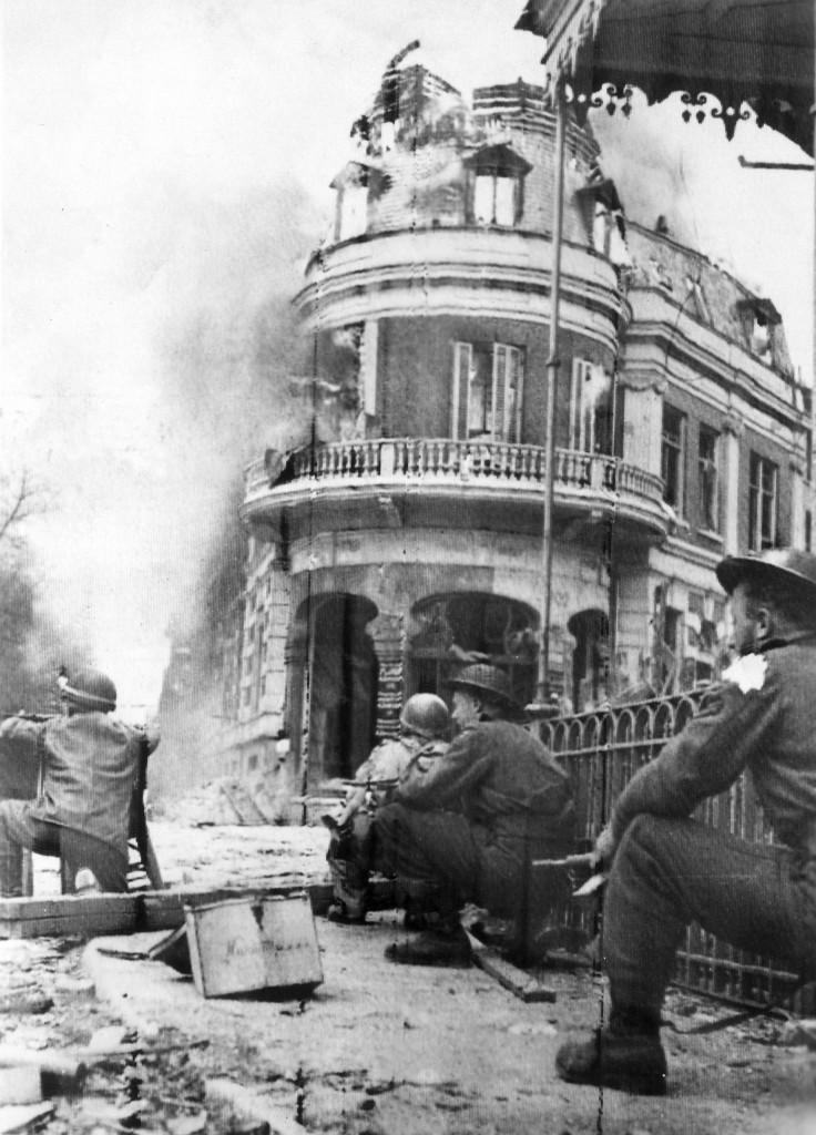
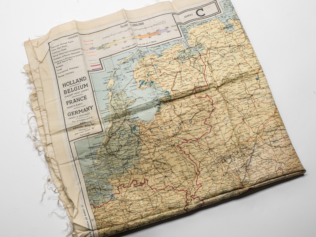
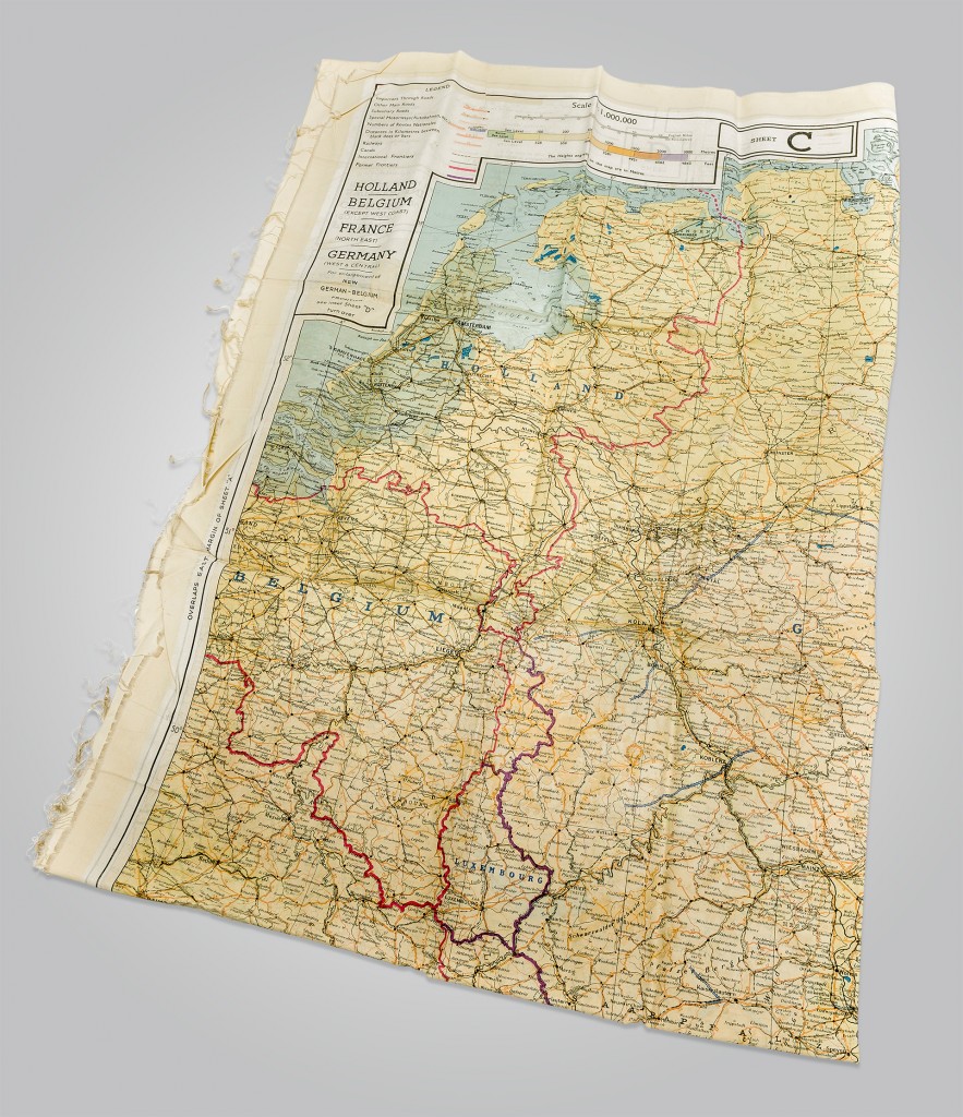
These types of maps were distributed to paratroopers and pilots in case they needed to plot an escape route from occupied territories. Frost was part of the largest airborne operation of the war until then, code-named Market Garden. Three battalions were ordered to advance to the bridge over the River Rhine in the city of Arnhem, but only Frost’s battalion succeeded. Nearly 750 lightly-armed soldiers took up positions around the northern approach to the bridge. The German opposition was stronger than expected. The plan was for British ground troops from Belgium to arrive at the bridge in Arnhem within two days to join the fight, but this was far too optimistic. Also the British airborne troops in the nearby village of Oosterbeek were unable to reach their brothers-in-arms. In the early morning of 21 September, the last soldiers at the bridge were forced to surrender. Frost was wounded and taken prisoner – his silk roadmap went unused.